NEODAAS is part of a team calibrating and characterising instruments operated by the NCEO Airborne Earth Observatory.
The NERC Earth Observation Data Analysis and AI Service (NEODAAS) worked with the National Centre for Earth Observation (NCEO) Airborne Earth Observatory (NAEO), the Field Spectroscopy Facility (FSF) and 2Excel Geo this spring to calibrate and characterise airborne instruments used to support NERC and ESA projects, helping to preserve the quality and long-term value of airborne Earth Observation (EO) data.
Regular calibration and characterisation of EO sensors is an important cornerstone to high quality data collection. As sensors age, subtle changes in instrument performance can occur, potentially affecting data quality and consistency. To address this challenge, NEODAAS works closely with NAEO and FSF as well as commercial partners 2Excel Geo to perform an annual calibration of the Specim AsiaFENIX 1K and Specim AsiaIBIS sensors operated by NAEO. Sensor calibration is the process of ensuring a sensor’s measurements are accurate by comparing them against known reference standards. Sensor characterisation tests how the sensor performs, helping researchers better understand the data it collects. For example, sensitivity of the instrument at different wavelengths and how this might affect algorithms they apply to it. The calibration of airborne hyperspectral imagers, such as the the Specim AsiaFENIX 1K, presents unique challenges due to the large number of spatial channels and spectral bands.
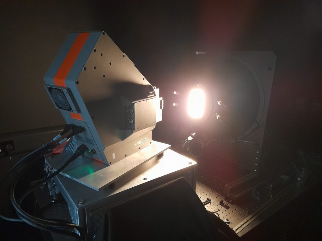
Figure 1: Specim Aisa FENIX 1K set up to measure uniform radiance from a integrating sphere. The instrument is set up on a rotation platform to enable full coverage of the field of view.
The team developed a robust methodology for the calibration of the Specim AisaFENIX 1K operated by the NCEO Airborne Earth Observatory. A similar approach has also been developed for the high spectral resolution NAEO Specim AisaIBIS, which is designed to measure Solar induced Fluorescence (SiF) from vegetation. NEODAAS specifically contributed data processing expertise, using an in-house developed suite of software tools to automate processing the calibration data collected and produce output coefficients that could be used when processing airborne data. Based on those results, NEODAAS produces seasonal data quality reports and calibration outputs that are indispensable for any scientific analysis derived from NCEO airborne data. This work ensures that researchers can continue to use the Airborne Earth Observatory data with confidence, supported by a robust understanding of instrument calibration history and sensor performance throughout its operational lifetime.