In July and August 2025 NEODAAS provided satellite data to the RRS Discovery cruise DY196 which was conducting research at the Celtic Sea shelf break as part of the NERC-funded PISCES project (Processes drIving Submarine Canyon fluxES). The aim was to understand how hydrodynamic processes in submarine canyons – such as upwelling and internal tide-driven mixing – transport nutrients across the shelf break, influencing marine ecosystems and biogeochemical cycles.
A major focus was the detection of internal solitary waves, which play a critical role in nutrient flux. These waves were previously observed during an earlier cruise (JC237), and the team anticipated similar patterns during DY196. NEODAAS provided timely Synthetic Aperture Radar (SAR) imagery from the Copernicus Sentinel 1A and 1C satellites, enabling researchers to identify internal solitary wave signals during calm conditions at the shelf break. SAR data can provide information on surface structure of the ocean and is able to observe through clouds.
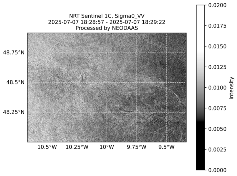
The project PI, Dr Rob Hall gave the following feedback, “The SAR imagery was really exciting, especially as we had some really flat days out at the shelf break. There were definitely internal solitary wave signals in the images you sent us… I’m hopeful that we can use the imagery to determine the wavelength and propagation direction of internal solitary waves we see in the ship 150 kHz ADCP data.”
In addition, Sea Surface Temperature (SST) and chlorophyll data supplied by NEODAAS from the Coperncus Sentinel 3A and 3B satellites were used to compare with ship underway measurements, adding valuable context to in-situ observations.
This project highlighted how satellite data provided through NEODAAS can complement ship-based measurements by providing coverage over a larger area. These ship-based measurements can in turn improve the interpretation of satellite data to provide time-series information outside research cruises.