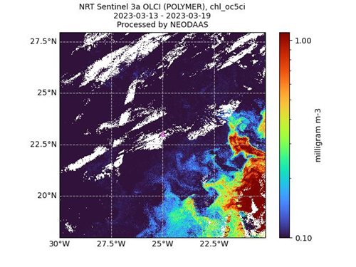
NEODAAS often provides near-real time support to ship-based research missions, the most recent being the 30th Atlantic Meridional Transect (AMT); a six week annual research expedition that samples the open ocean between the UK and the southern tip of South America.
AMT is a multidisciplinary sampling programme, led by Plymouth Marine Laboratory (PML) and funded by Natural Environment Research Council's (NERC) National Capability, that undertakes biological, chemical and physical oceanographic research along the length of the Atlantic.
There is no other marine research activity like it in the Atlantic and it is a very important expedition for the marine science community, producing a unique dataset that is used by researchers around the world.
It also provides the opportunity to directly monitor changes in this expansive and dynamic ocean, and it is these somewhat challenging qualities of the Atlantic that can be largely overcome with frequent satellite imagery, by allowing a much wider view of the ocean and key oceanographic factors.
The NEODAAS team provided satellite images every week day throughout the 6 week voyage. These images presented the factors of sea surface temperature from the Sentinel 3 SLSTR sensor, and chlorophyll levels from the Sentinel 3 OLCI sensor. In total, the team provided 259 composite satellite images at the highest special resolution of 300m.

They were also able to provide products to suit the shifting needs of the mission, such as enhanced ocean colour to highlight plankton blooms and potential sargassum patches.
Dr Gavin Tilstone, scientist onboard AMT30 and Bio-optical Oceanographer at Plymouth Marine Laboratory, commented:
“The support that NEODAAS provides is extremely valuable to the scientists involved with AMT. NEODAAS’ near-real time satellite imagery provides a wider perspective of the oceanographic conditions ahead and around the ship, such as areas of high phytoplankton biomass, which help us to improve the quality of our data collection and plan our experiments. For example, this year the satellite images helped us navigate toward large patches of sargassum to facilitate sampling it for further research. In turn, we take measurements for validating the satellite imagery that we are provided by NEODAAS so that they can refine the quality of the products that they send out to the UK oceanographic community.”
Silvia Pardo, Research Scientist in NEODAAS, added:
“As well as providing near-real time data while the cruise is ongoing, NEODAAS utilises data collected during AMT to validate satellite data products they are providing. For example, data from previous AMT cruises helped determine the most accurate chlorophyll retrieval algorithm which was then used to provide data for this cruise.”